


Historical videos inspired by “Game of Thrones,” photos of long-lost neighborhoods, and maps of the best old buildings still standing today. What more could you ask for?
Amsterdam’s digital map archive was already one of the best municipal resources on the internet, and it just got even better. You may recall when CityLab first obsessed over the archive’s troves of information. We’re returning now to dive into the new maps, videos and archives that provide vivid, fascinating details on how the city has developed, some reaching back to the 1600s.

The Dutch Golden Age of the 17th century, was kind to Amsterdam. Within 100 years, rapid settlement tripled the city’s geographic size and dramatically expanded its network of canals and ramparts, as illustrated in this “Game of Thrones”-like video created by the City Archives.
From our partners:
Watch the reconstruction of Amsterdam’s defenses and you get an idea of the sheer effort it must have taken to expand this city built on marshy ground. Not only were the old ramparts demolished and rebuilt further out, but new canals had to be cut and old ones filled in.
What the video doesn’t show, however, was that this was actually the tip of the iceberg. Even something as simple as building a house could be complicated in Amsterdam’s boggy soil. The land could only be made safe for building by driving wooden pilings deep into it, until they reached the relatively stable sandy layer beneath. If the water level dropped and exposed the wooden pilings to air, they would shrivel and rot, giving rise to the occasional tilted, drunken-looking old building you can see today along Amsterdam’s canals.
Watch closely and you’ll also see how the city got its name. At the heart of the city is a broad dam over the river Amstel, the site of a square where, as the video shows, the old city hall burned down in 1648. Today, Dam Square sits on that location, remaining the heart of the city. Thanks to canals and building, it has since lost any sense of being near water.
The Age of Steam
Jump forward to the video above, documenting Amsterdam’s growth from 1800 to 1900, and what’s initially striking is how little had changed. In the east, much of the land absorbed by the city walls in the 17th century remained undeveloped. This was largely because demand for building land had slackened off as London gradually became Northern Europe’s trading hub. This arrested development means that, as the video shows, major 19th-century projects such as the Rijksmuseum and the Concertgebouw concert hall could be built on open land, but still be surprisingly close to the city core.
Destruction and rebuilding

Despite this rapid 19th-century development, there were still some lingering reminders of the more ramshackle, rustic city that was steadily replaced. This new photo archive map allows you to discover historic photos street by street and note how much from old Amsterdam lingered. An old windmill in the working class (but recently gentrified) De Pijp neighborhood, shown in this grainy photo from the archive, somehow managed to survive until 1881. The surrounding sheds and workshops became new streets of tenements soon after, and the site has since been inherited by a supermarket.

The archive also reveals some of the damage to Amsterdam during World War II, most of which is hard to spot today. Amsterdam suffered far more from the Holocaust—75,000 Jewish Amsterdammers lost their lives to Nazi persecution—and from the famine that came before the war’s end than from aerial bombardment. Nonetheless, the city suffered some destruction, such as these three houses destroyed in what was the Amsterdam’s Jewish quarter. The site has since been filled by a post-war shop and apartment block.

Buildings of quality
(City of Amsterdam)
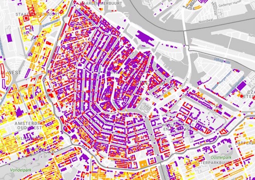
In Amsterdam, the sheer volume of architectural history that has remained is more striking than the number of buildings that have disappeared. One of the best ways to explore the detail of this architectural heritage is to use the city’s map of buildings of recognized architectural value constructed before 1965, street by street. You can use it to zoom in on every building that the city has registered as high quality. The detail pop-ups even provide the construction year and the name of its architect.
While this is great for locals looking up the buildings in their own neighborhood, it’s also great for architectural tourists whose interest in Amsterdam’s buildings strays beyond the usual suspects. While Amsterdam’s historic canal rings are shaded purple—the color marking the most highly protected structures—you can also zoom out to Amsterdam’s less visited suburbs to find newer, more unlikely architectural treasures.
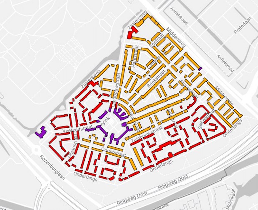
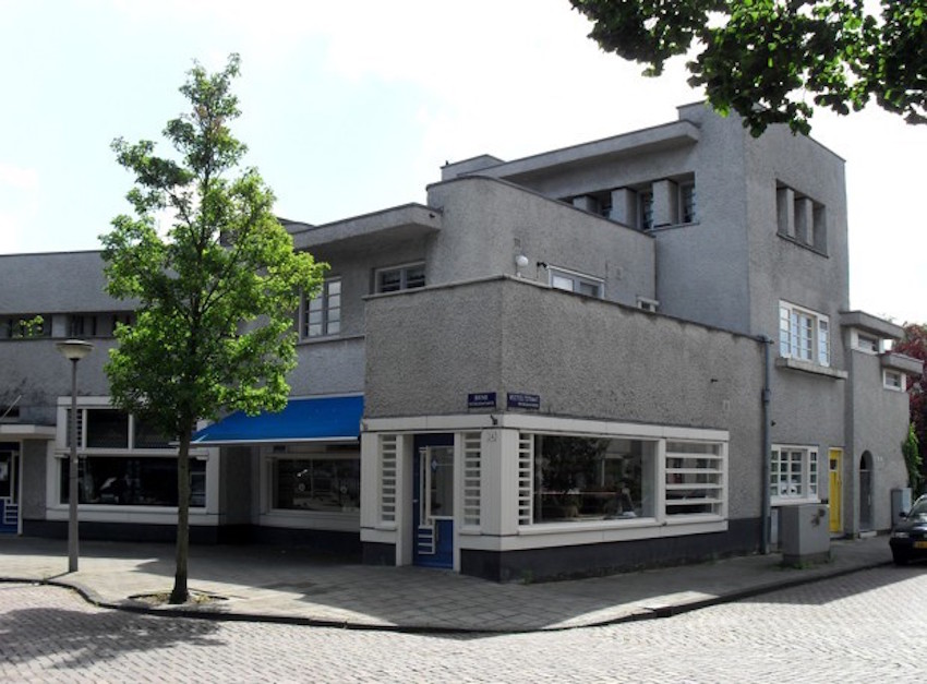
Zoom in on the southern section of the map, for example, and you will notice the highly protected cluster of buildings at Betondorp—“Concrete Village” in English—a modernist quarter designed by architect Dick Greiner in the 1920s. Even people who normally dislike gray concrete can appreciate the detailing of roofs, windows, and doorways on show here.
Switching between the archive and Google Street View, you could lose hours comparing historic photos, contemporary views and architectural ratings, if your mind is nerdish enough to want to. That alone is testament to the city archivists’ effort: Amsterdam is clearly working hard to make sure that people engage with it and its history as deeply as possible.
This feature originally appeared in Citylab.

From our partners:


