


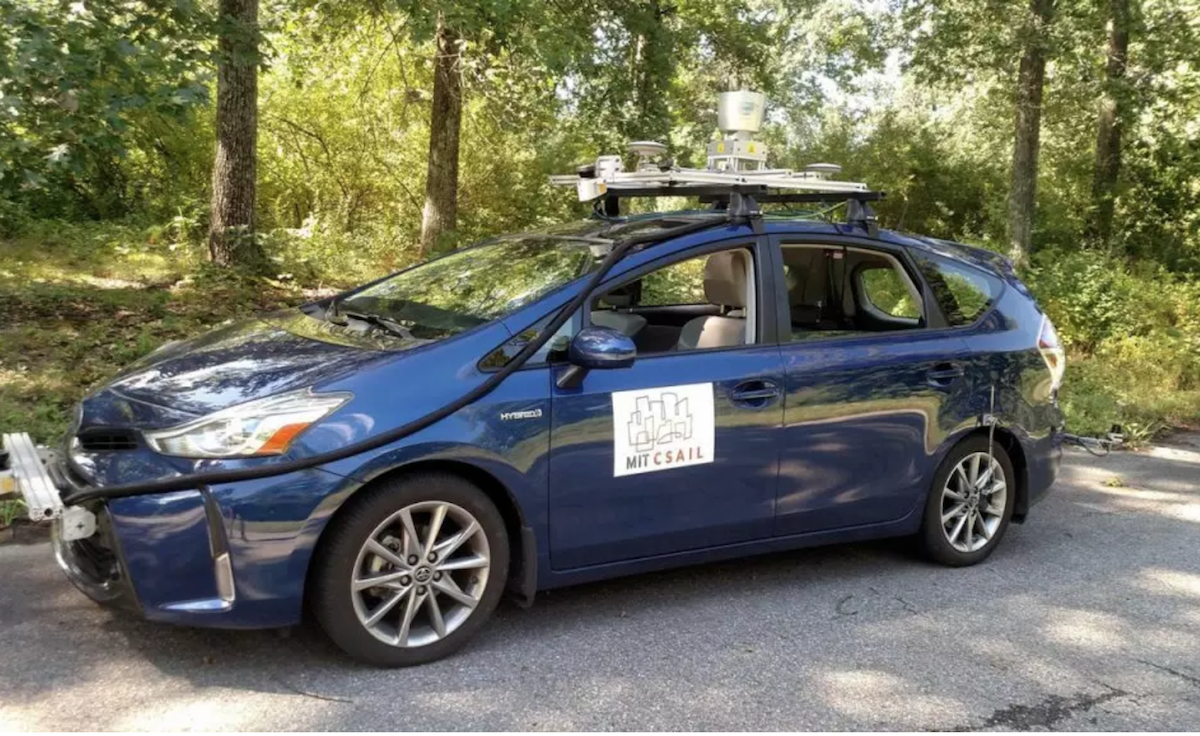
Right now, most self-driving cars–like those being developed by Google or Uber–can only operate in very limited urban areas of the United States. In part, that’s because these cars need extremely accurate 3D maps that are constantly updated to function properly. That makes them impossible to use on millions of miles of roads outside cities–a problem that MIT engineers at the Computer Science and Artificial Intelligence Laboratory are tackling with a new system using just basic GPS, laser sensors, and artificial intelligence to navigate rural roads. Its name is MapLite.
Without public transit, rural areas are often in need of alternative modes of transit. “Urban areas already have many forms of transportation, including public transit and ride-sharing fleets, which give those who cannot drive their own vehicles a number of options,” says MIT CSAIL grad student and lead research author Teddy Ort over email. “[I]f autonomous cars can reach the millions of people who live beyond the city and are unable to pilot their own vehicles, they will be uniquely capable of providing mobility to those who have very few alternatives.” Plus, they could make rural roads–which are statistically the most dangerous–much safer.
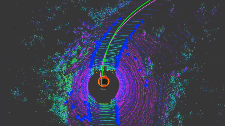
The engineers note that their experimental system isn’t perfect. It won’t work on mountain roads, for example, since it can’t handle the changes in elevation. Yet they plan to keep working on it, teaching the system to respond to new road conditions and elevation changes. Eventually, MapLite could reach the accuracy of conventional, map-powered autonomous cars.
From our partners:
Ort doesn’t think that this technology will fully replace detailed 3D maps in urban areas, though. “In the densely populated and highly structured environment of a city, it is unlikely that maps will be completely discarded,” he tells me. “[H]owever, [MapLite] will still prove useful both as a method of learning when the map needs to be updated, and as a critical extra layer of safety in the event the vehicle is unable to localize on the map.”
Knowing how fatal a single mistake can be, any extra safety layer sounds sensible to me.
This feature is written by Jesus Diaz & originally appeared in FastCo Design.


From our partners: